Acquire
Take each record at its source and at the finest grain available.
THE ASSET LAYER · GROUND
The ground beneath the real economy, made legible.

THE MODEL
Medini is the widest lens in the Nataraja system. It extends owned intelligence into the physical substrate beneath enterprise, infrastructure and capital—turning land from fragmented records into a coherent model.
THE ARCHITECTURE
No single dataset is the product. The advantage is the composition: source-level capture, identity, graph, recovered documents and geometric contradiction assembled into one operating layer.
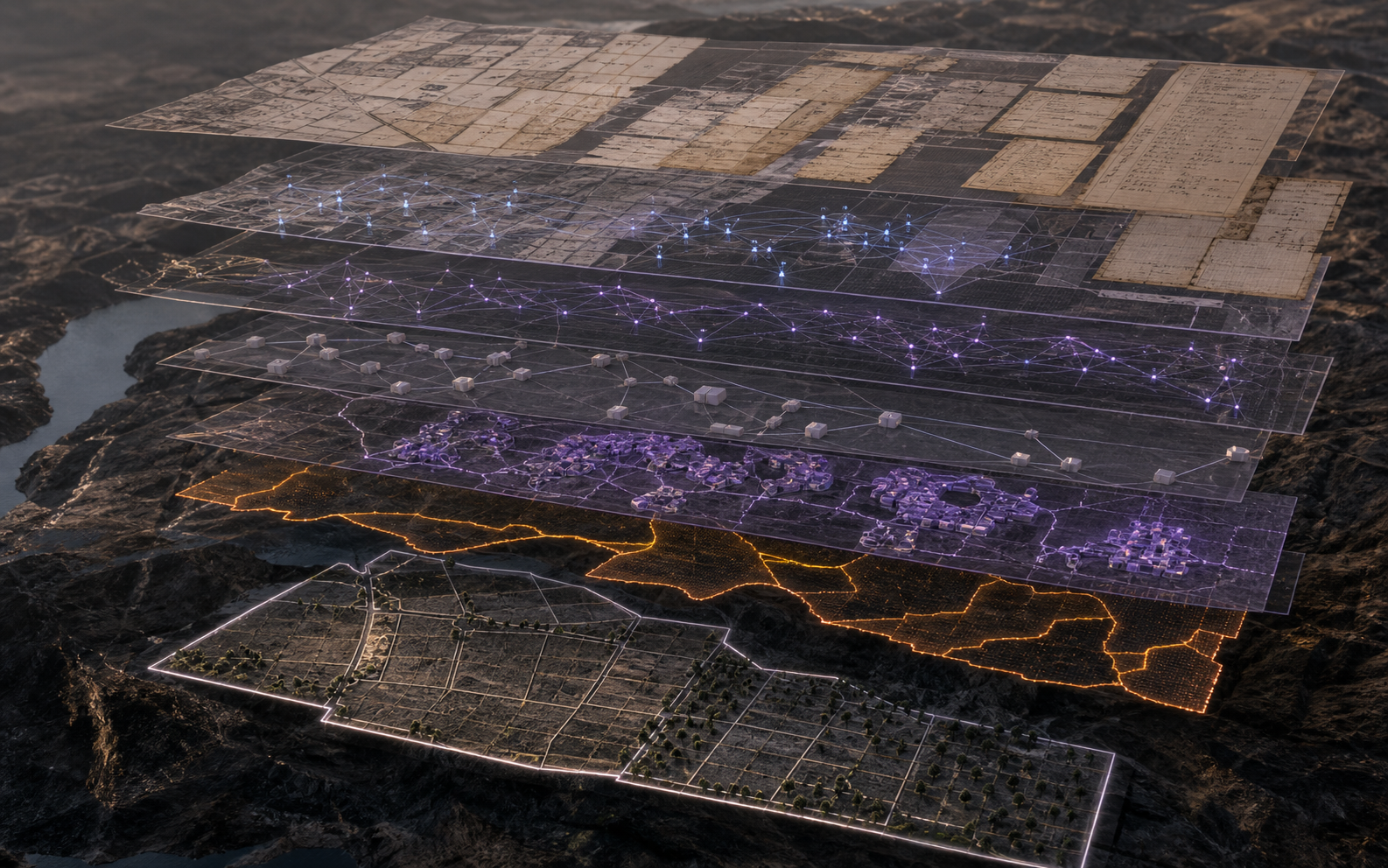
Take each record at its source and at the finest grain available.
Make separate state systems and record formats speak one consistent language.
Collapse spellings, scripts and aliases into the verified people and entities behind them.
Reassemble transactions into relationships between owners, parcels and documents.
See one subject at once as landholder, company, developer and party to acquisition.
Read facts still locked inside scanned deeds, gazettes and original paper records.
Surface the named places where ownership, protection, use and infrastructure disagree.
Resolve the parcel and its physical relationship to infrastructure, use and surrounding assets.
Connect ownership and control to the wider corporate and economic graph.
Make encumbrance, claims and other hidden friction visible within the asset itself.
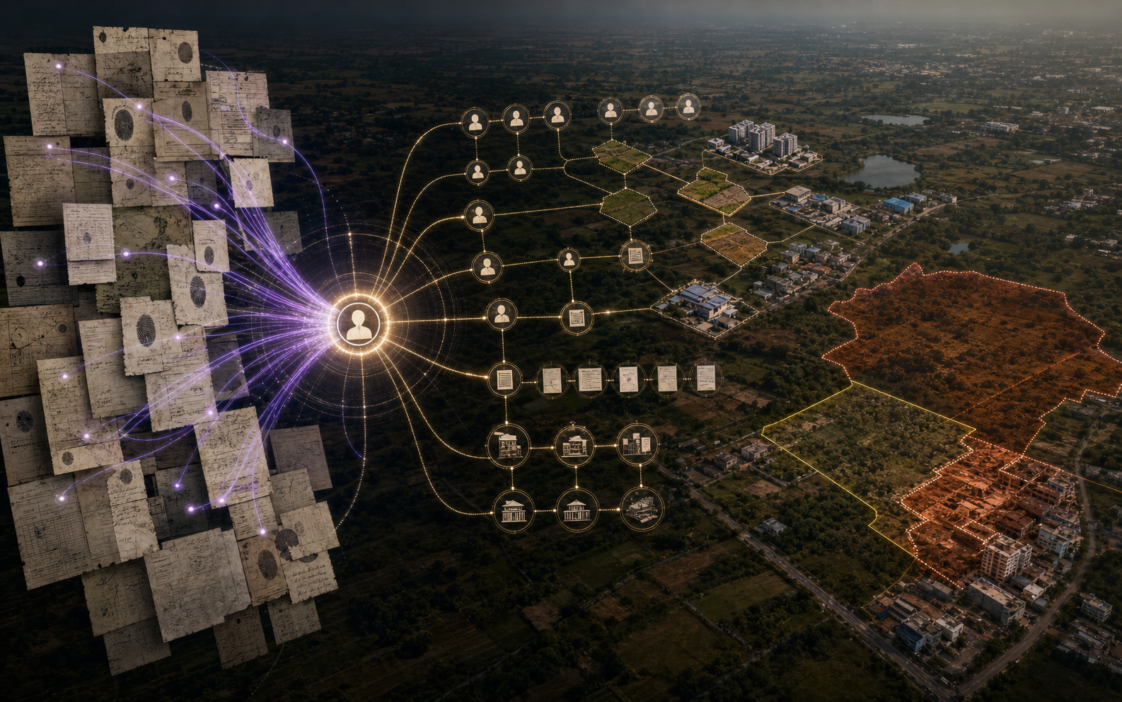
THE CONTRADICTION ENGINE
THE PRODUCT SURFACE
The map remains connected to resolved identity, transaction chronology, source documents and geometric conflict—so every spatial conclusion can be followed back to the evidence that produced it.
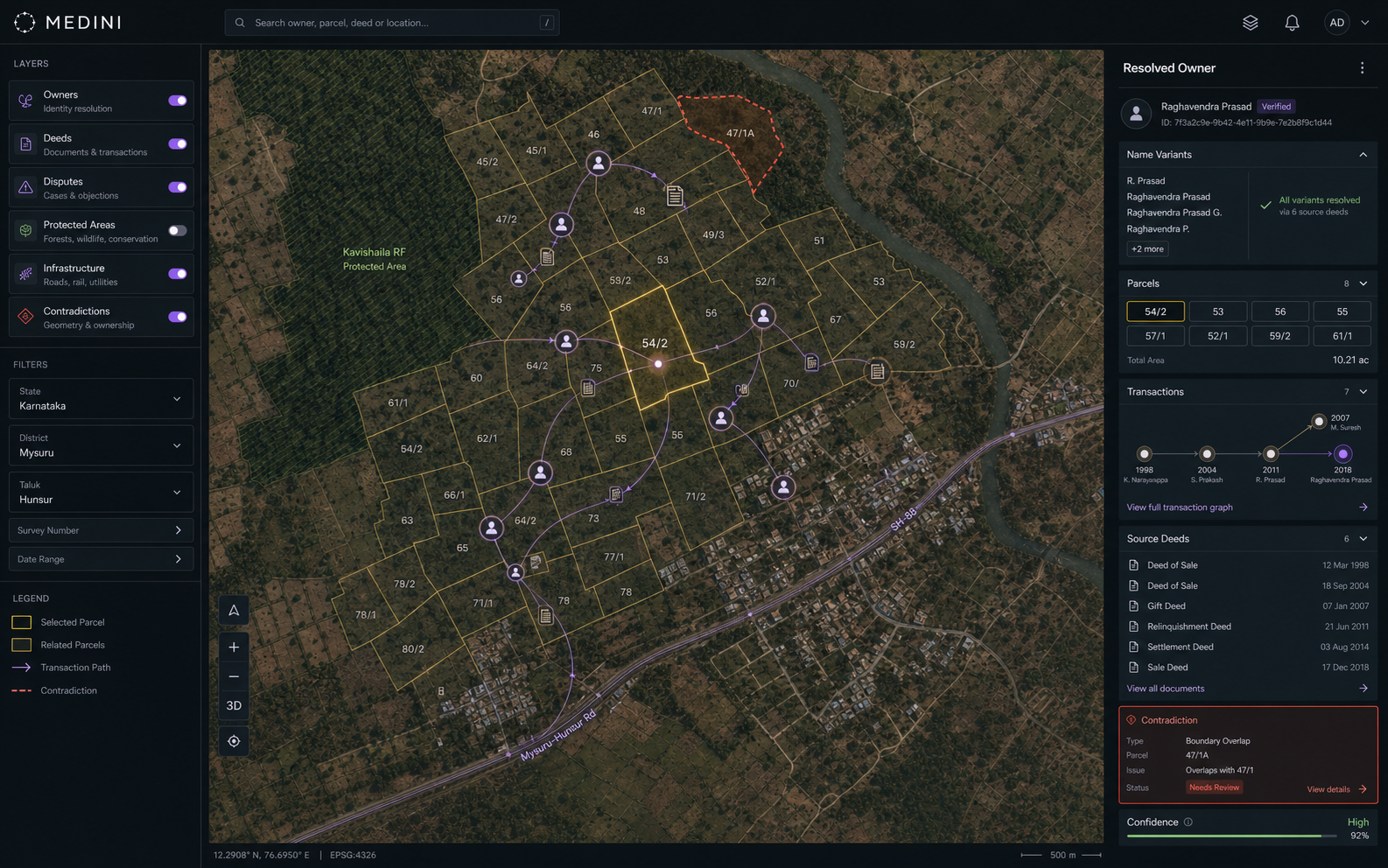
LAND-GRAPH CASE · IDENTITY RESOLUTION
Medini resolved repeated spelling and script variants into a verified identity, rebuilt the deeds and parcels around that owner, and exposed a recurring acquisition and distribution pattern no individual record contained.
Registry search treated each name variant as a different person and each deed as an isolated event. The real owner footprint, counterparties, parcel flow and contradictions therefore remained invisible—or were distorted by false same-name matches.
Source registry rows, identity anchors, name variants, scanned deeds, parcel geometry, transaction chronology, counterparties, corporate links, infrastructure and protected-area layers.
Resolve aliases to one identity, remove false matches, rebuild the transaction graph, link every deed to parcels and counterparties, recover locked document facts and test the geometry for contradiction.
A source-traceable owner and parcel view that reveals recurring channels, related holdings and conflicts while preserving the exact deed, identity and map evidence behind every conclusion.
Capture ownership, deed and parcel evidence before it is simplified or separated by an aggregator.
Collapse spelling and script variants into one identity while excluding unrelated people with the same name.
Connect each purchase and sale to its parcel, document, date and counterparty.
Read evidence that remains inside scanned deeds and original registry documents.
Surface recurring acquisition, distribution and pass-through relationships across the graph.
Join ownership to disputes, infrastructure and protected-area layers to name the contradiction.
No individual record contains the pattern. It appears only when identity, transactions, documents and geometry are composed into one queryable layer—and every join remains traceable to source.
HOW IT HOLDS
Where House Model maps an operation, Medini maps the ground that operation stands on. It is the broader asset layer in the long arc toward a verifiable model of the real economy.
The physical world becomes queryable without being flattened into a generic map. Each layer remains grounded in the records and relationships that give it meaning.
WHO IT SERVES
ONE ENGINE · EVERY LAYER CONNECTED
ContinueAbout Nataraja Labs→